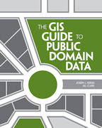
A recurring topic in conferences, workshops, blogs, forums, listservs, and around the water cooler over the past 25 years is about spatial data–where to find it, how to use it, how does one know if the data is any good, privacy vs. access issues, spatial data infrastructures, copyright and licensing, fee vs free, cloud vs desktop, crowdsourcing, and a host of other topics. I am glad to report that a book I co-authored on this topic has just been published, and is described below.
This book is accompanied by a blog: Spatial Reserves with weekly updates and news on the issues explored in the book.
The book is also accompanied by 10 activities free to use that involve the access and use of public domain data to solve problems ranging from selecting the most suitable locations for tea cultivation in Kenya, investigating the Gulf Oil Spill, siting a café in a metropolitan area, assessing citizen science portals, creating an ecotourism map in New Zealand, analyzing sustainable land use in Brazil, analyzing floodplains in Colorado, and much more, on:
ArcGIS Online group entitled The GIS Guide to Public Domain Data.
The activities include the step-by-step instructions, questions, answer keys, quizzes, and the spatial data. The intention is for the data to be accessed on the original sites at the FAO, USGS, UNEP, etc – but if for some reason those sites are down or slow, the data are all packaged up at the above link.
Press Release:
The GIS Guide to Public Domain Data Explains Sources and Quality of Spatial Data
Redlands, California—June 4, 2012—The GIS Guide to Public Domain Data, published by Esri Press, provides GIS users with detailed information about the sources and quality of spatial data available in the public domain and the policies that govern its use.
This guide covers practical issues such as copyrights, cloud computing, online data portals, volunteered geographic information, and international data. It provides GIS practitioners and instructors with the essential skills to find, acquire, format, and analyze public domain spatial data. Supplementary exercises are available online to help put the concepts into practice.
“This book fills a very big gap in the literature of GIS and brings together for the first time discussions of issues users of public domain data are likely to confront,” says Michael F. Goodchild, professor of geography at the University of California, Santa Barbara (UCSB), and director of UCSB’s Center for Spatial Studies. “It will prove useful to GIS practitioners in any area of GIS application, including students anxious to learn the skills needed to become GIS practitioners and data producers who want their data to be as useful as possible.”
Written by Joseph J. Kerski and Jill Clark, the guide provides a critical evaluation of the various public domain data portals available and the merits of their data. Foreword by Dr Michael Goodchild, University of California Santa Barbara.
The GIS Guide to Public Domain Data (ISBN: 978-1-58948-244-9, 388 pages, US$49.95) is available at online retailers worldwide, at Esri Press, at Amazon, or by calling 1-800-447-9778. Outside the United States, visit esri.com/esripressorders for complete ordering options, or visit esri.com/distributors to contact your local Esri distributor.


