Announcing new book: Spatial Thinking in Environmental Contexts: Maps, Archives, and Timelines

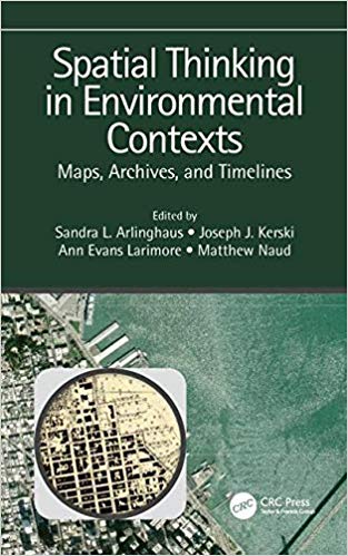
Announcing my newest book:Spatial Thinking in Environmental Contexts: Maps, Archives, and Timelines,  published by CRC Press, 2019.

Spatial Thinking book

Spatial Thinking book

This book cultivates the spatial thinking “habit of mind” as a critical geographical view of how the world works, including how environmental systems function, and how we can approach and solve environmental problems using maps, archives, and timelines. The work explains why spatial thinking matters as it helps readers to integrate a variety of methods to describe and analyze spatial/temporal events and phenomena in disparate environmental contexts. It weaves together maps, GIS, timelines, and storytelling as important strategies in examining concepts and procedures in analyzing real-world data and relationships. The work thus adds significant value to qualitative and quantitative research in environmental (and related) sciences.

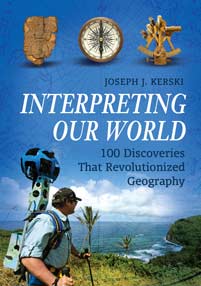
Interpreting Our World: 100 Discoveries That Revolutionized Geography

This important book demonstrates why geography matters in the modern-day world through its examination of 100 moments throughout history that had a significant impact on the study of geography—literally, “writing about the earth.”

Geography is not simply accounts of the lands of earth and their features; it’s about discovering everything there is to know about our planet. This book shows why geography is of critical importance to our world’s 21st-century inhabitants through an exploration of the past and present discoveries that have been made about the earth. It pinpoints 100 moments throughout history that had a significant impact on the study of geography and the understanding of our world, including widely accepted maps of the ancient world, writings and discoveries of key thinkers and philosophers, key exploration events and findings during the Age of Discovery, the foundations of important geographic organizations, and new inventions in digital mapping today.

The book begins with a clear explanation of geography as a discipline, a framework, and a way of viewing the world, followed by coverage of each of the 100 discoveries and innovations that provides sufficient background and content for readers to understand each topic. The book concludes with a concise synopsis of why it all matters and a look forward to 10 possible future discoveries in the next 50 years of geography. Students will gain a clear sense of what is truly revolutionary about geography, perhaps challenging their preconceived notion of what geography actually is, and grasp how important discoveries revolutionized not only the past but the present day as well.

Features

  • Provides readers with an understanding of why geography matters to our 21st-century world and an awareness of how geography affects our everyday lives and is key to wise decision making
  • Addresses and explains key themes of geography, including scale, physical processes, cultural processes, patterns, relationships, models, and trends
  • Integrates time, space, and place in geography, documenting how it is not only the study of spatial patterns, but also the fact that many discoveries in geography came about because of the particular time and place in which the discoverers lived

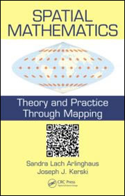
Spatial Mathematics: Theory and Practice through Mapping

SPATIAL MATHEMATICSAuthors: Sandra Lach Arlinghaus, University of Michigan, Ann Arbor, Michigan,
USA
; Joseph J. Kerski

Anticipated publication date: July 18, 2013 by CRC Press – 299 Pages | ISBN 9781466505322

Features

•Written by a field leader in education involving mathematics and mapping software and a field leader in mathematical geography
•Supplies robust material and exercises tested in workshop situations
•Includes software to which exercises are geared
•Explains and includes QR (quick response) codes that link text to downloads server
•Focuses on detailed illustrations of mathematical backgrounds in GIS with an interdisciplinary interaction

Summary

Spatial mathematics and analysis, two different approaches to scholarship, yield different results and employ different tools. This book explores both approaches to looking at real world issues that have mathematics as a critical, but often unseen, component. Readers learn the mathematics required to consider the broad problem at hand, rather than learning mathematics according to the determination of a (perhaps) artificial curriculum. This format motivates readers to explore diverse realms in the worlds for geography and mathematics and in their interfaces.

Pre-order it now from CRC Press: http://www.crcpress.com/product/isbn/9781466505322

International Perspectives on Teaching and Learning with GIS in Secondary Schools

International Perspectives on Teaching and Learning with GIS in Secondary SchoolsInternational Perspectives on GIS in Secondary Schools

Publication Date: January 2012 | ISBN-13: ISBN 978-94-007-2119-7

.

  • Is the first book to capture an international perspective on the status of GIS in schools.
  • Included in each chapter at least one author who currently lives and works in the country profiled and can thus provide the most appropriate local perspective on the country.
  • Demonstrates that GIS is not only a technological tool to be used in the classroom, but it is also an avenue for motivation, encouragement, and cooperation in understanding and solving global problems.
  • Provides many different examples, ideas, and methods of using GIS and GPS in secondary schools from around the world.
  • Features inquiry-based learning about current events using real-world data in a problem-solving, technology-driven environment.

This, the first publication to collate a broad international perspective on the pedagogical value of GIS technology in classrooms, offers an unprecedented range of expert views on the subject. Geographic Information Systems (GISs) are now ubiquitous and relatively inexpensive. They have revolutionized the way people explore and understand the world around them. The capability they confer allows us to capture, manage, analyze, and display geographic data in ways that were undreamt of a generation ago. GIS has enabled users to make decisions and solve problems as diverse as designing bus routes, locating new businesses, responding to emergencies, and researching climate change. GIS is also having a major impact in the classroom. Students and teachers around the world are using this significant emerging technology in the secondary school classroom to study social and scientific concepts and processes, to broaden their technical skills, and to engage in problem solving and decision making about local and global issues.

International Perspectives on Teaching and Learning with GIS in Secondary Schools brings together authors from 34 countries who profile the current status of GIS in secondary school teaching and learning in their country. Each chapter includes a summary of the country’s educational context, a case study illustrating how GIS is used in secondary schooling, and an assessment of the opportunities and challenges in teaching and learning with GIS now and in the future. The book demonstrates that GIS is not only a technological tool to be used in the classroom, but also a catalyst for motivation, encouragement, and cooperation in understanding and solving global problems.

Buy “International Perspectives on Teaching and Learning with GIS in Secondary Schools” at Amazon.com or as a Kindle edition on Amazon or from Springer.

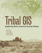
Tribal GIS: Supporting Native American Decision Making

Tribal GIS: Supporting Native American Decision Making

Publication Date: June 16, 2012 | ISBN-10: 1589483200 | ISBN-13: 978-1589483200

In Tribal GIS: Supporting Native American Decision Making, tribal leaders tell their stories about implementing and using geographic information systems (GIS) to address their unique challenges as sovereign Nations. This book covers applications in natural resources and the environment, transportation, cultural and historical preservation, economic development, health, education, public safety, and agriculture. Showing how tribal governments responsible for the stewardship of their land and resources and the health and well-being of their People use enterprise GIS to make decisions, Tribal GIS supports tribes new to GIS and those with GIS experience.

Buy “Tribal GIS” at Amazon.com

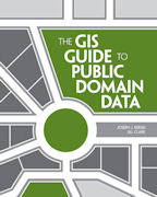
New Book: The GIS Guide to Public Domain Data

The cover of The GIS Guide to Public Domain Data book.

A recurring topic in conferences, workshops, blogs, forums, listservs, and around the water cooler over the past 25 years is about spatial data–where to find it, how to use it, how does one know if the data is any good, privacy vs. access issues, spatial data infrastructures, copyright and licensing, fee vs free, cloud vs desktop, crowdsourcing, and a host of other topics. I am glad to report that a book I co-authored on this topic has just been published, and is described below.

This book is accompanied by a blog: Spatial Reserves with weekly updates and news on the issues explored in the book.

The book is also accompanied by 10 activities free to use that involve the access and use of public domain data to solve problems ranging from selecting the most suitable locations for tea cultivation in Kenya, investigating the Gulf Oil Spill, siting a café in a metropolitan area, assessing citizen science portals, creating an ecotourism map in New Zealand, analyzing sustainable land use in Brazil, analyzing floodplains in Colorado, and much more, on:

ArcGIS Online group entitled The GIS Guide to Public Domain Data.

The activities include the step-by-step instructions, questions, answer keys, quizzes, and the spatial data. The intention is for the data to be accessed on the original sites at the FAO, USGS, UNEP, etc – but if for some reason those sites are down or slow, the data are all packaged up at the above link.

Press Release:
The GIS Guide to Public Domain Data Explains Sources and Quality of Spatial Data

Redlands, California—June 4, 2012—The GIS Guide to Public Domain Data, published by Esri Press, provides GIS users with detailed information about the sources and quality of spatial data available in the public domain and the policies that govern its use.

This guide covers practical issues such as copyrights, cloud computing, online data portals, volunteered geographic information, and international data. It provides GIS practitioners and instructors with the essential skills to find, acquire, format, and analyze public domain spatial data. Supplementary exercises are available online to help put the concepts into practice.

“This book fills a very big gap in the literature of GIS and brings together for the first time discussions of issues users of public domain data are likely to confront,” says Michael F. Goodchild, professor of geography at the University of California, Santa Barbara (UCSB), and director of UCSB’s Center for Spatial Studies. “It will prove useful to GIS practitioners in any area of GIS application, including students anxious to learn the skills needed to become GIS practitioners and data producers who want their data to be as useful as possible.”

Written by Joseph J. Kerski and Jill Clark, the guide provides a critical evaluation of the various public domain data portals available and the merits of their data. Foreword by Dr Michael Goodchild, University of California Santa Barbara.

The GIS Guide to Public Domain Data (ISBN: 978-1-58948-244-9, 388 pages, US$49.95) is available at online retailers worldwide, at Esri Press, at Amazon, or by calling 1-800-447-9778. Outside the United States, visit esri.com/esripressorders for complete ordering options, or visit esri.com/distributors to contact your local Esri distributor.

The Implementation and Effectiveness of GIS in Secondary Education: Geographic Information Systems in Education

Publication Date: July 22, 2009

Some educators consider GIS to be one of the most promising means for implementing educational reform. However, GIS technology has been adopted by only 1% of American high schools. This research describes the geographic and curricular extent to which GIS technology and methods are being implemented in secondary education in the USA, explains why and how GIS is being implemented, and assesses the effects of GIS-based lessons on teaching and learning. A national survey of 1,520 high schools provided primary data to explain the extent of the implementation. A set of experiments and case studies provided primary data for assessing the effects of GIS. GIS provides issues-based, student-centered, standards-based, inquiry-oriented education, but its effectiveness is limited primarily by social and structural barriers. GIS is implemented primarily by veteran science teachers at high schools who perceive that GIS provides interdisciplinary, real world relevance. Results of experiments were mixed. Case studies showed that GIS changes teacher and student roles, communication, and methods of teaching and learning.

Buy this book at Amazon.com

Two chapters in Digital Geography: “Geospatial Technologies in the Social Studies Classroom”

Publication Date: February 12, 2008 | ISBN-10: 1593116721 | ISBN-13: 978-1593116729
A volume in International Social Studies Forum: The Series Series Editors Richard Diem, University of Texas at San Antonio and Jeff Passe, University of North Carolina, Charlotte The purpose of this volume is to provide a review and analysis of the theory, research, and practice related to geospatial technologies in social studies education. In the first section, the history of geospatial technologies in education, the influence of the standards movement, and the growth of an international geospatial education community are explored. The second section consists of examples and discussion of the use of geospatial technologies for teaching and learning history, geography, civics, economics, and environmental science. In the third section, theoretical perspectives are proposed that could guide research and practice in this field. This section also includes reviews and critiques of recent research relevant to geospatial technologies in education. The final section examines the theory, research, and practice associated with teacher preparation for using geospatial technologies in education.

 Buy this book at Amazon.com

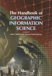
The Handbook of Geographic Information Science

Chapter entitled “Geographic Information in Education”
August 2007
ISBN: 978-1-4051-0796-9

John Wilson and A. Stewart Fotheringham, Editors

This Handbookis an essential reference and a guide to the rapidly expanding field of Geographic Information Science.

  • Designed for students and researchers who want an in-depth treatment of the subject, including background information
  • Comprises around 40 substantial essays, each written by a recognized expert in a particular area
  • Covers the full spectrum of research in GIS
  • Surveys the increasing number of applications of GIS
  • Predicts how GIS is likely to evolve in the near future

Available from the publisher, Wiley

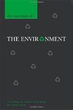
The Essentials of the Environment

Publication Date: February 16, 2006 | ISBN-10: 0340816325 | ISBN-13: 978-0340816325
Environmental issues such as possible climate change, pollution, nuclear waste, water resources, food and famine have a high public as well as political profile. The role that humans may have played in causing some of these problems, as well as some of the things we could do to reduce their impact, are also topics of major interest. The Essentials of the Environment presents a fascinating insight into these subjects and many more, providing general information and informed discussion enhanced by international case studies. The book is illustrated throughout with photographs and figures and comprehensive cross-references guide the reader to related issues. Important technical details are presented in stand-alone boxes and guides to further resources are included for the reader wishing to delve further into particular issues.

Anyone concerned about their environment will find this an essential reference addressing all the key issues from oil spills to global warming to genetic engineering. It will also be a great course companion for students for physical geography and the environment.

Buy this book at Amazon.com

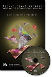
“Using GIS to Transform the Mathematical Landscape”

A math-based chapter written with Dr. Bob Coulter  in “Technology-Supported Mathematics Learning Environments 67th Yearbook” (2005)
By William Masalski, Portia Elliott.
Edited by William J. Masalski

Technology is playing an increasingly important role in the teaching and learning of mathematics at all levels. This publication reports on overviews of research and findings on the impact of technology. It furnishes a rich context in which to observe teachers in prekindergarten through grade 12 and teacher educators using technology to help their students better understand mathematics, and gives us all a glimpse of what the future might hold in store for us. The accompanying CD includes electronic features that enhance an understanding of the articles presented in the printed yearbook.

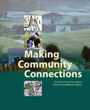
Foreword in “Making Community Connections: The Orton Family Foundation Community Mapping Program”

Publication Date: July 1, 2003

Making Community Connections calls for a more integrative look at the world we live in. Invariably, the Community Mapping Program makes more clearly visible the connections of various factors affecting the particular object of study. Concepts of sustainability, responsibility, integration, and the larger picture, find their way into classroom discussions and are then mapped in multiple different ways.

Available at Amazon.com