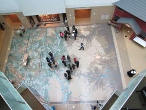
I recently created and ran a Colorado History and Geography Quiz on a giant terrazzo map of the state at the History Colorado museum. The participants had to stand on the part of the state, on the map, that indicated their answer. Try it out for yourself! You don’t need a giant map to do it. But think about fun and creative ways that you can spread your love for geography and geospatial to those outside your community.
Quiz 1
1. What is the largest county in Colorado?
2. What is the shortest border that Colorado shares with another state?
3. In what county is state highway 1 located?
4. In what county is state highway 2 located?
5. Where are the headwaters of the Rio Grande (river)?
6. Colorado has 4 national monuments. Not parks, but monuments. What are they?
7. What is the 3rd largest city in Colorado?
8. What is the lowest elevation in Colorado and where is it?
9. What is the highest elevation in Colorado and where is it?
10. This county contains the following place: Last Chance. Where is the county?
Quiz 2
1. What is the smallest county in Colorado in terms of area?
2. This county contains the following towns: Craig and Maybell. What county is it and where is it?
3. This town received its name from where the Gunnison River flows into the Colorado River. Which town is it, and where is it located?
4. Which county produces more agricultural output than any other county?
5. This town contains a famous theatre, Madonna of the Trail, and is also antipodal not to an ocean but to Ile Amsterdam, an island. Which is it?
6. Which unlikely town in Colorado, because of its size, was the town of the 1929 and 1930 boys state high school basketball champions?
7. What is the lowest town in Colorado in terms of elevation?
8. Where was the coldest temperature in Colorado recorded? Where was the hottest temperature in Colorado recorded?
9. From 1990 to 2003, this county was the fastest growing county in the USA. What is the name of this county?
10. What and where is the oldest town in Colorado, founded in 1851?
Answers:
Quiz 1.
1. Las Animas County.
2. Oklahoma, along the southeastern border of Colorado.
3. Highway 1 is in Larimer County, north of Fort Collins.
4. Highway 2 is in Denver County, along Colorado Boulevard.
5. The headwaters of the Rio Grande are due east of Silverton, across the ridge, in Hinsdale County.
6. Florissant, Colorado, Hovenweep, and Yucca House are Colorado’s 4 national monuments.
7. Aurora, Colorado.
8. 3315 feet, where the Arikaree River flows into Kansas.
9. Mt Elbert, west of Buena Vista.
10. Washington County.
Quiz 2
1. Broomfield County.
2. Moffat County.
3. Grand Junction.
4. Weld County.
5. Lamar, Colorado.
6. Joes, Colorado.
7. 3387 feet: Holly, Colorado.
8. Maybell, Colorado. -61 F on 11 Feb 1985.
Bennett, Colorado. + 118 F on 11 July 1888.
9. Douglas County.
10. San Luis, in Conejos County, Colorado.


